
Cyclone Narelle Intensifies to Category 5, Threatens Far North Queensland Coast
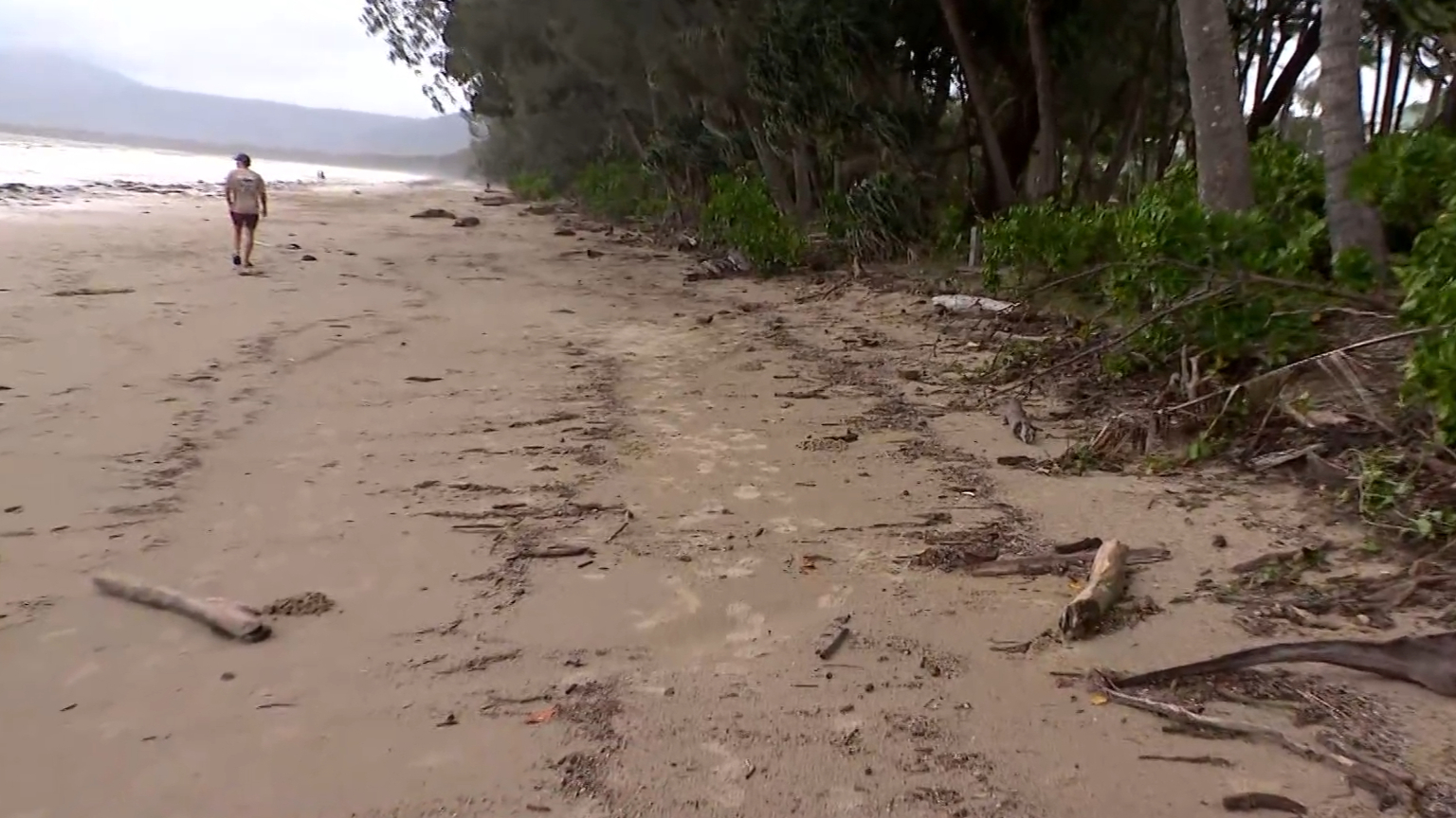
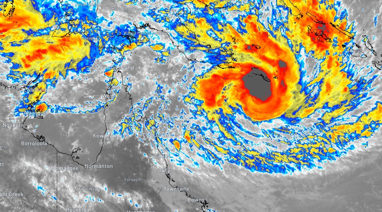
A powerful Category 5 Tropical Cyclone, named Narelle, is currently tracking towards the Far North Queensland coast, prompting urgent preparations and warnings of widespread damage. The cyclone is expected to make landfall tomorrow morning between Lockhart River and Cooktown, bringing with it a perilous combination of heavy to intense rainfall and extremely destructive winds.
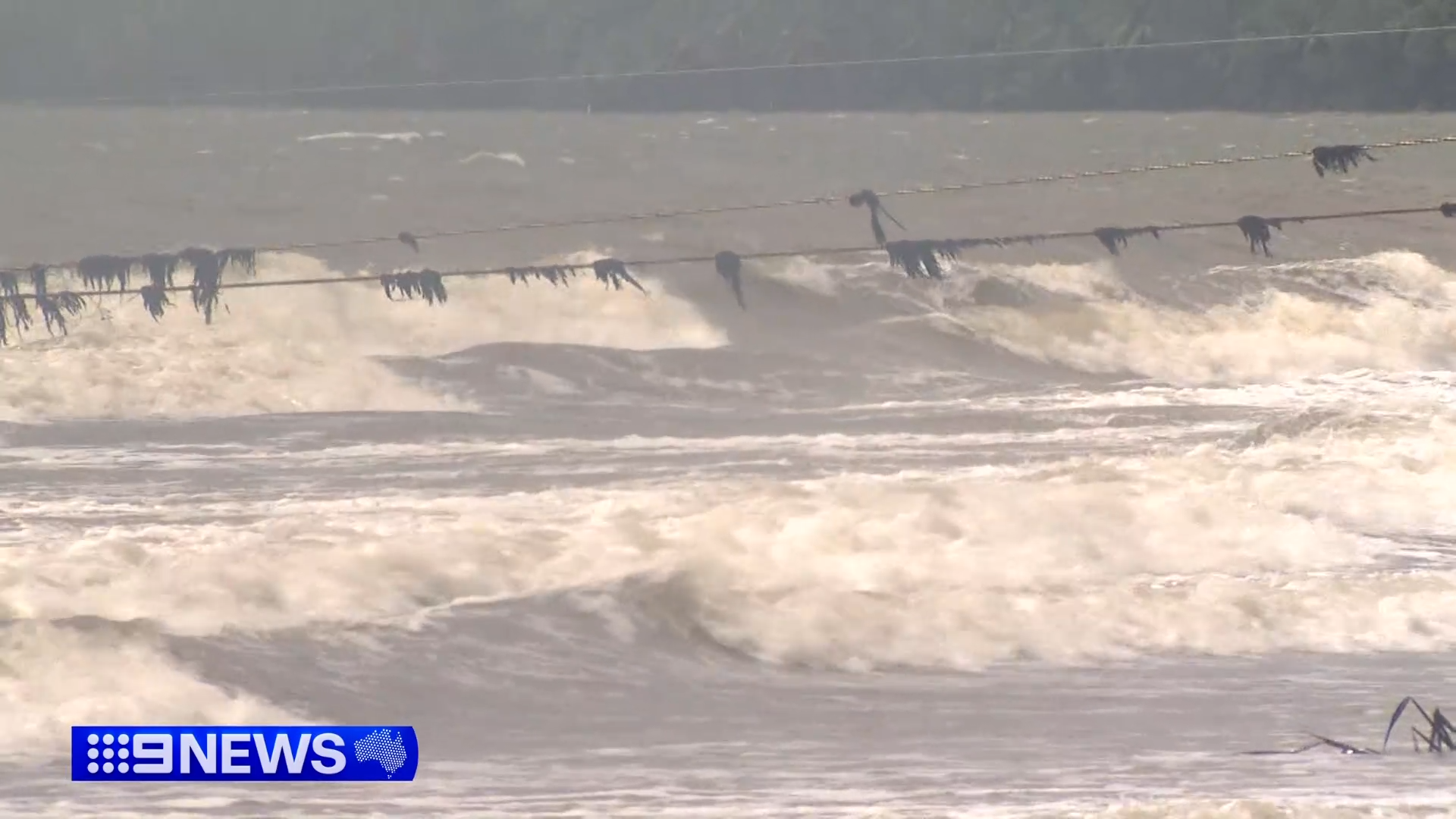
The Bureau of Meteorology (BOM) has issued a stark warning, indicating that the cyclone could bring damaging wind gusts reaching up to 300km/h. Coupled with this ferocious wind is the threat of heavy to locally intense rainfall, significantly increasing the risk of flash flooding across coastal and inland areas.
Queensland Premier David Crisafulli has not minced words, describing the impending event as a “serious event” and confirming that significant preparations are already underway. “I can’t sugarcoat this,” the Premier stated grimly, “the damage will be widespread with a system like this.” He provided crucial context, highlighting the rarity and severity of such an occurrence. “If a Category 5 system crosses the coast in this location, it’ll be the first time it’s happened in over 100 years,” Crisafulli explained. He further emphasised the historical significance, noting, “If a Category 5 system crosses the Queensland coast, it’ll be just the fourth time that’s happened in half a century.” The Premier implored residents to heed official advice, urging them to “take precautions and do the little things that make all the difference.”
The cyclone warning zone currently stretches from Cape Tribulation in the south to Lockhart River in the north, with the alert extending inland to the western reaches of the Cape York Peninsula.
Premier Crisafulli acknowledged the unique geography of the affected region. “Because it’s a narrow part of the state,” he explained, “there is a prospect that even though the system will weaken as it crosses land, it still has the potential to have some serious winds as it goes across those communities all the way across.”
The current forecast indicates that Cyclone Narelle will cross over Cape York Peninsula as a tropical cyclone during Friday, though it is expected to weaken during this landfall.
However, the threat is far from over. After crossing the peninsula, the system is predicted to continue its westward trajectory across the Gulf of Carpentaria. Crucially, it is forecast to strengthen once again into a severe tropical cyclone before impacting the eastern Northern Territory over the weekend.
Northern Territory on Alert as Cyclone Narelle Heads West
The Bureau of Meteorology has alerted residents in the Port McArthur and Nhulunbuy regions of the Northern Territory to expect the development of gales from Saturday. The agency further warned of the possibility of destructive winds and heavy rainfall, which could trigger flash flooding in these areas.
“People between Port McArthur and south of Nhulunbuy should consider what action they will need to take if the cyclone threat increases,” the BOM advised, urging proactive planning.
https://x.com/BOM_au/status/2034532650346840527
Prime Minister Anthony Albanese has been briefed on the situation and echoed the concerns about the storm’s potential impact. He described the cyclone as having the potential to be a “very dangerous” weather event for both Queensland and the Northern Territory. “The Category 4 cyclone is forecast into a Category 5 system before crossing with severe impacts on Friday,” Albanese stated.
The Prime Minister confirmed ongoing engagement with Premier Crisafulli. “I’ve been engaged and will continue to engage with Premier David Crisafulli,” he said. “As always, the Commonwealth stands ready to provide whatever assistance is required for both Queensland and the Northern Territory.”
Residents in affected areas are strongly advised to stay informed through official channels and to complete all necessary preparations to ensure their safety and the protection of their property. This includes securing outdoor items, ensuring emergency kits are stocked, and having a clear evacuation plan if necessary. The approaching cyclone represents a significant weather event, and vigilance and preparedness are paramount.


