Emergency Flood Warnings Issued for Bundaberg as Burnett River Threatens Major Flooding
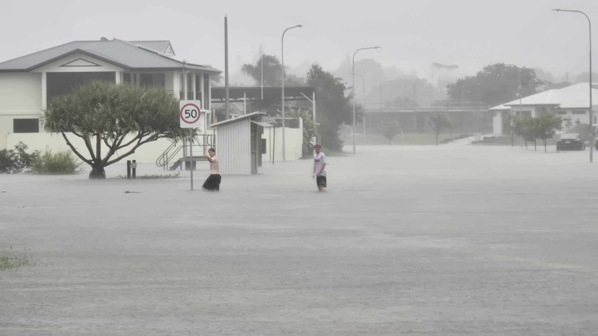
Residents in four Bundaberg suburbs have been issued with an urgent “leave immediately” warning as the Burnett River braces for major flooding, with levels potentially mirroring the devastating 2010 event that saw hundreds of homes evacuated. The Bureau of Meteorology (BOM) has forecast that the Burnett River is expected to surpass 7 metres from 3pm on Tuesday afternoon, with a projected peak of 7.6 metres overnight. This significant rise could impact approximately 180 properties.
Authorities have specifically directed residents in Bundaberg North, Bundaberg East, Bundaberg South, and Bundaberg Central to evacuate, emphasizing that their lives are at risk. The council has also alerted the community that both the Tallon and Burnett Bridges will be closed as the river levels climb, potentially cutting off safe evacuation routes.
Mayor Helen Blackburn urged those in low-lying areas to seek refuge at evacuation centres or with friends and family on the southern side of the river. “We encourage people who are in low-lying areas to find their way to evacuation centres or to go to friends and family on the south side [of the river],” she stated. The Mayor stressed the importance of remaining calm but alert, advising residents to move if necessary.
The BOM has warned that flooding across the Wide Bay, Burnett, Southern Downs, and Capricornia regions could persist for several days. Forecaster Dean Narramore explained that while the heaviest rain has eased, the floodwaters will continue to move downstream, impacting inland areas for an estimated three to four days.
Flood Peaks Across the Region
Further upstream, the Burnett River in Mundubbera peaked overnight at an imposing 16.97 metres. North Burnett Deputy Mayor Melinda Jones noted that this level is alarmingly close to inundation for the local bridge and the first houses in the town. While the North Burnett Regional Council has since downgraded its warnings and advised residents it is safe to return home, the broader flood threat remains.
Major flood warnings have also been issued for several other key river systems across Queensland, including the Mary River, Dawson River, Upper Balonne River, Flinders River, Warrego River, Georgina River, and Thomson River. These widespread flood events have led to numerous road closures, with the Capricorn Highway between Blackwater and Emerald being particularly affected.
One resident, Rob Stringer, living west of Mundubbera, described his property as “totally isolated” with the nearest bridge submerged. He anticipates being cut off for at least two to four days as floodwaters from the north make their way downstream.
In the Central Highlands, the town of Sapphire and surrounding areas are also experiencing isolation due to heavy rainfall. The Capricorn Highway remains flooded in multiple locations between Rockhampton and Emerald, highlighting the extensive impact of the weather system.
Prepare for Localised Flooding
The Western Downs Region Council is anticipating major flooding at Charley’s Creek in Chinchilla, with levels expected to peak by midday on Thursday. Some homes are likely to be affected, prompting an urgent call for residents to prepare evacuation plans, especially as nightfall approaches. The township of Warra, north-west of Dalby, is also at risk of flooding tonight, with further highway closures anticipated. Residents are advised to stay with family or friends if possible and to monitor the disaster dashboard for the latest updates.
Closer to the coast, Agnes Water and its surroundings have become isolated following significant rainfall near Baffle and Captain Creeks.
Dams Reaching Capacity and Expected to Spill for Weeks
Queensland’s dam infrastructure is also under pressure, with 10 out of 23 dams currently spilling. Paradise Dam, west of Bundaberg, is operating at 203 per cent capacity and is releasing excess water into the Burnett River. Sunwater anticipates that many of these dams will continue to spill for weeks, if not months, due to the sustained rainfall.
In Maryborough, minor flooding is expected today as the Mary River, which reached major flood levels yesterday afternoon, is forecast to peak. Fraser Coast Mayor George Seymour has indicated that while the river is high, the current forecast suggests the peak will not reach the severity of the 2022 floods that necessitated widespread evacuations. He reassured residents familiar with Maryborough’s flood patterns that this event is unlikely to match the scale of previous major floods. Three bridges over the Mary River – Granville, Lamington, and Burrum River Bridges – were closed by Monday evening.
The State Emergency Service (SES) in Bundaberg has responded to a significant number of calls, with deputy local controller Luke Harding urging residents to prepare, particularly those who experienced flooding in 2010. The SES has stressed the critical importance of avoiding floodwaters, citing a rise in rescues that are stretching resources.
Outlook: Rain Easing, But Floodwaters Remain
While the immediate threat of heavy rainfall is subsiding as the weather system moves offshore, BOM senior meteorologist Christie Johnson confirmed a “clearing trend” for Tuesday. Lingering showers are expected for a couple of days, but dry conditions are anticipated by Thursday. However, a monsoon trough in North Queensland is set to bring steady rainfall to the Gulf and Northern regions later in the week, indicating that flood concerns may persist in other parts of the state.


