Young Boy Rescued from Floodwaters as Extreme Weather Lashes Northern Australia
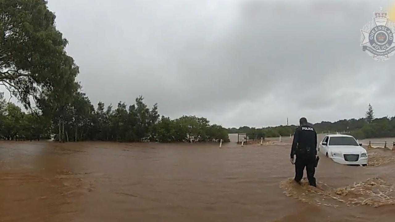
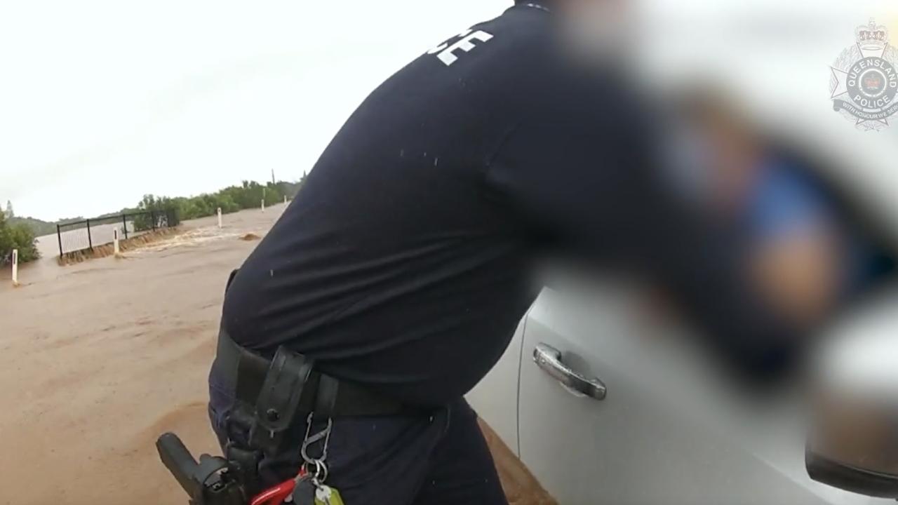
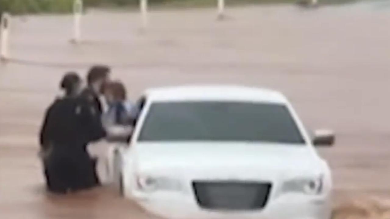
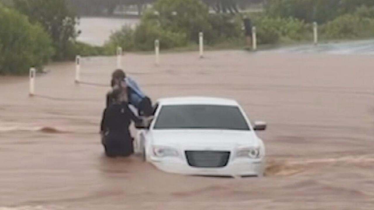
A dramatic rescue unfolded on Queensland’s Central Coast this week, as emergency services pulled a young boy to safety from a car trapped in raging floodwaters. The incident occurred near Bargara, approximately 13 kilometres east of Bundaberg, where a vehicle attempted to navigate a flooded causeway.
Police footage captured the harrowing moments officers waded into fast-flowing torrents to reach the child. The rescue took place around 7:40 am on Monday, following a barrage of calls to emergency services from motorists stranded across the Wide Bay district.
The extreme weather has not only endangered lives but also caused significant disruption. In a separate incident on the Burnett Highway, near Murgon Gayndah Road, one man found himself trapped on the roof of his vehicle for several hours. While helicopters were initially tasked with his rescue, worsening weather conditions forced them to stand down. Ultimately, the man was safely extricated by boat, reportedly uninjured.
Authorities have issued stern warnings to drivers, urging them to exercise extreme caution and to always check road conditions before embarking on any journey. The message is clear: never attempt to drive through floodwaters. A police spokesperson emphasised the importance of adapting to the conditions, advising motorists to slow down and implement extra precautions in areas affected by flooding.
A 54-year-old Bundaberg resident learned this lesson the hard way, receiving a substantial $667 fine for driving without due care and attention. In another incident in Gayndah, North Burnett, two women managed to free themselves from a car that had become submerged in floodwater on Brian Pastures Road.
Widespread Rainfall and Flash Flood Risks
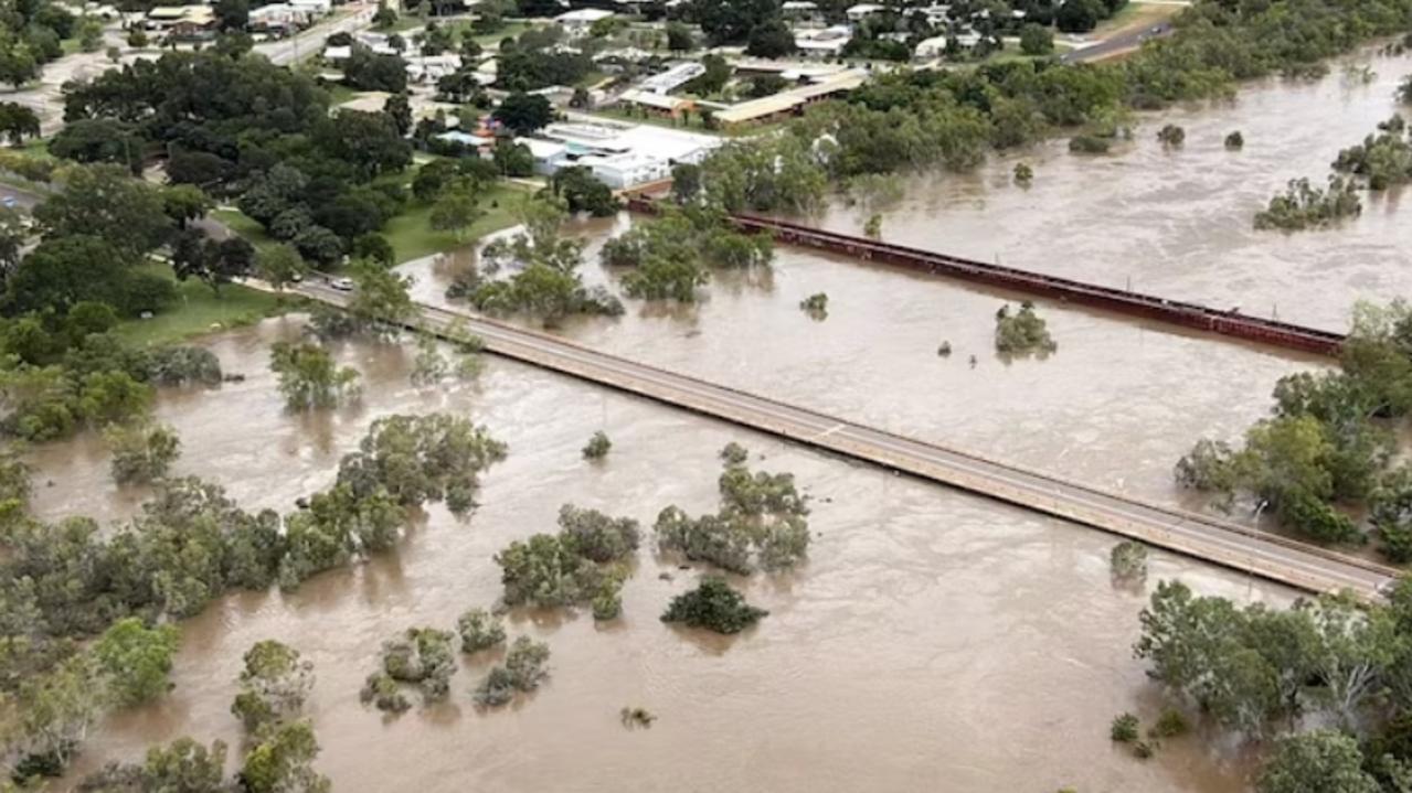
The Bureau of Meteorology issued a stark warning about the escalating risk of flash flooding. Persistent rainfall, driven by a weather system moving in from the northwest, lashed the region from Sunday through to Monday morning. Widespread rainfall totals of 80mm to 150mm were recorded across the Wide Bay-Burnett catchment, alongside parts of the Sunshine Coast, southern Capricornia, and the Central Highlands and Coalfields areas.
Meteorologist Miriam Bradbury noted that some isolated rainfall totals were significantly higher, underscoring the unpredictable nature of the downpours.
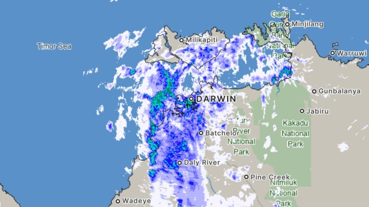
“Panic Buying” Grips Darwin Amidst Northern Territory Flooding
Meanwhile, the Northern Territory is grappling with its own severe weather crisis. In Darwin, a wave of “panic buying” has swept through supermarkets, leaving shelves stripped bare as residents brace for prolonged isolation. Videos circulating on social media platforms, such as TikTok, depict empty aisles in a Darwin Coles supermarket, a stark contrast to its usual abundance.
User @siennamallonn, in a video posted on Sunday night, explained the situation to viewers: “We’re in Coles right now seeing what’s left in Darwin because there’s been flooding in Katherine, so all the roads are closed.” The footage captured shelves devoid of essential items like bread, fruit, and long-life milk. One shopper remarked that the situation was “worse than Covid,” while another expressed disbelief, stating she had “never seen anything like this in (her) whole life.”
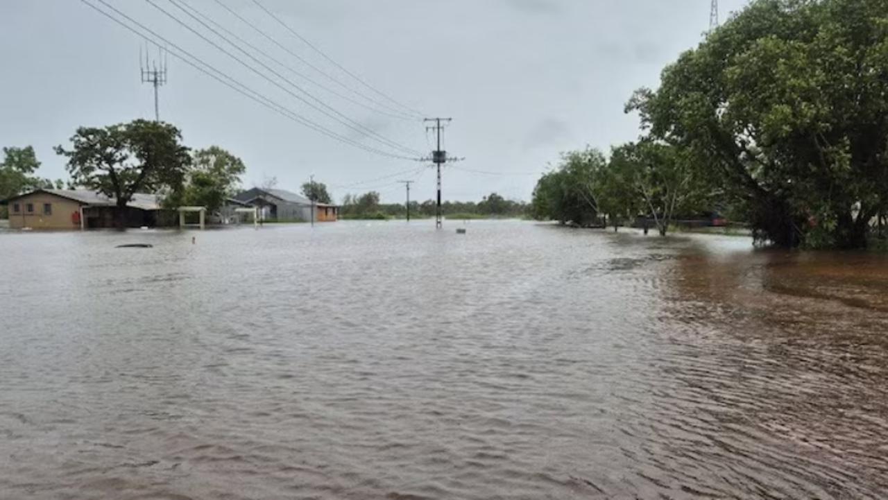
The torrential rainfall has exacerbated the inherent isolation of outback towns, with a dual low-pressure system wreaking havoc across both the Northern Territory and Queensland. The vital Stuart Highway has been severed in both directions on either side of Katherine, effectively cutting off the town’s 10,000 residents from Darwin to the north and Alice Springs to the south.
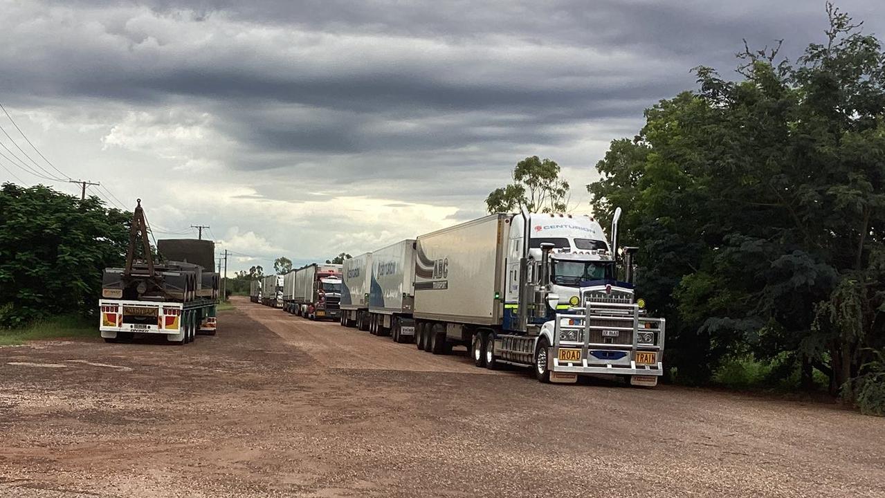
On Monday night, images shared on Facebook by user Joan Miller showcased a line of road trains parked near the Larrimah Hotel, located 180 kilometres southeast of Katherine. These essential supply convoys were awaiting clearance to proceed north through Katherine and into Darwin.
The Northern Territory Emergency Service has been actively engaged in supplying stranded residents with food and other necessities at community evacuation centres throughout the weekend.
Major Flood Warnings Issued for Katherine and Daly Rivers
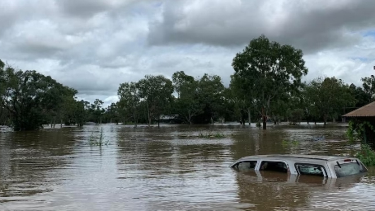
Meteorologist Helen Reid confirmed that a major flood warning remains in effect for the Katherine River. At its peak, water levels at the Katherine Bridge reached 19.2 metres, a height not seen since the devastating floods of April 2006. By Monday morning, the water level had receded to 17.4 metres, just below the major flood threshold.
The Daly River is also experiencing significant flooding, with water levels at the Daly River police station registering 14.7 metres – well above major flood levels. Ms. Reid cautioned that this is a “slowly rising river” and that the peak may not be reached for several days. Furthermore, the decline in flood levels is expected to be gradual, with major flooding likely to persist for most of the week.
Showers and thunderstorms are forecast to continue in the coming days, with the potential for isolated heavy falls. With saturated grounds and already swollen rivers, any further rainfall could lead to renewed rises in flood levels, even in areas where levels are beginning to recede.
Queensland’s Coastal and Inland Flood Concerns
Queensland has also endured a significant deluge, with heavy rainfall now moving away from the north coast and progressing towards the central and southeastern coasts, as well as the central interior. Meteorologist Helen Reid noted that particularly during Sunday afternoon, rain rates intensified across the Central Highlands and Coalfields, Wide Bay and Burnett, and the Southeast Coast regions. Higher rainfall totals were also recorded in parts of the Maranoa and Warrego, and the northern Darling Downs.
Along the coast, moderate to locally heavy falls extended as far south as the northern Brisbane suburbs and the Sunshine Coast, with lighter falls experienced on the Gold Coast. Overnight, rainfall intensified significantly in areas north of the Sunshine Coast, primarily within the Wide Bay and Burnett District.
Between 9 am on Sunday and 5 am on Monday, Brovinia recorded an impressive 239mm of rain, Boondooma received 209mm, and Kuranda saw 199mm.
Ms. Reid predicted that Monday would be a wet day across “broad parts of central and South East Queensland,” as a low-pressure trough draws in substantial moisture. Inland Queensland, in the Central Highlands and Coalfields district, is expected to receive between 60-90mm of rainfall, with isolated totals potentially reaching around 150mm. These intense rain rates could trigger dangerous, potentially life-threatening flash flooding. Widespread flood warnings remain in place as river systems continue to rise under the persistent rainfall.


