Twin Tropical Cyclones Impacting Melanesia
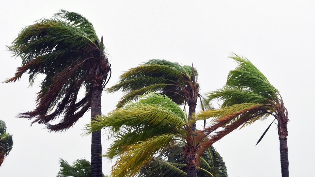
Two tropical cyclones are currently causing significant disruption across Melanesia, with Maila and Vaianu both posing serious threats to the region. These powerful systems are generating destructive winds exceeding 120 km/h, affecting areas such as the Solomon Islands and Fiji.
On Tuesday afternoon AEST, both cyclones were classified as category three systems, indicating their potential for severe damage. The impact of these storms is expected to extend beyond the immediate region, with models predicting wild weather conditions in Australia and New Zealand by the end of the week.
Vaianu’s Path and Effects
Vaianu is located west of Fiji and is moving southwards, with its tail bringing storms and rain to the main island of Viti Levu. Although it is not expected to make landfall, the worst of the weather is anticipated on Tuesday. This system is closely monitored by meteorologists, who are tracking its movement and potential impacts on the region.
Maila’s Stagnation and Potential Movement
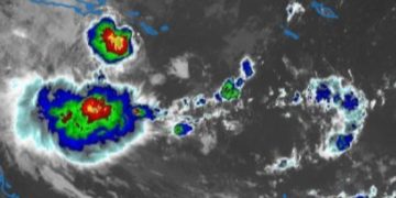
In contrast, Maila has remained relatively stationary for several days, brewing in the warm waters between Papua New Guinea and the Solomon Islands. Philip Duncan, the head forecaster at WeatherWatch, described the situation as “a wheel stuck in mud,” highlighting the slow movement of the storm.
Although the eye of Maila is currently at sea, the fringes of the storm have already affected the Western and Choiseul regions of the Solomon Islands. The Solomon Islands Prime Minister, Jeremiah Manele, has activated national disaster management arrangements, issuing a red alert for those areas.
Models suggest that Maila will eventually move westward towards the end of the week, potentially tracking over the tip of the Papuan Peninsula and then heading towards Queensland north of Cooktown. If this path materializes, it will pass near the area where Cyclone Narelle made landfall as a category four storm in March. At that point, the cyclone may weaken and be downgraded to a tropical low.
Impacts on Fiji and Potential Spread
On Tuesday, posts from the Fiji Meteorological Service highlighted the flooding caused by Vaianu in Nadi, a key tourism hotspot and home to the region’s largest airport. Mr. Duncan noted that the system is moving south rapidly, avoiding Tonga and likely impacting New Zealand.
“The storm curves around … and that means it’s getting pretty confident now this storm is going to come into New Zealand this weekend,” he said. The computer modelling has been consistent for a couple of days, indicating a high likelihood of the storm affecting the North Island near Auckland or Tauranga around Sunday.
Comparison to Past Storms
Mr. Duncan compared the potential intensity of this storm to Cyclone Gabrielle, which struck in 2023. Gabrielle resulted in a dozen fatalities and billions of dollars in damages, primarily due to lost agricultural exports and infrastructure.
“European modelling showed 969 hectopascals. That is very low air pressure. Cyclone Gabrielle was 965,” he said, emphasizing the severity of the current system.
As the situation continues to evolve, authorities and residents in affected areas are advised to stay informed and prepared for the potential impacts of these powerful tropical cyclones.


