Eastern Australia Braces for Continued Deluge and Flood Risk
Parts of eastern Australia are set to endure another drenching this weekend as a significant weather system, originating from the outback, continues its march across the continent. This system has already delivered record-breaking rainfall to central Australia, with some areas experiencing their highest totals in up to 15 years. The unusual intensity of these desert downpours is attributed to a rare intrusion of highly humid tropical air, which has now settled over Queensland and is expected to linger for several days.
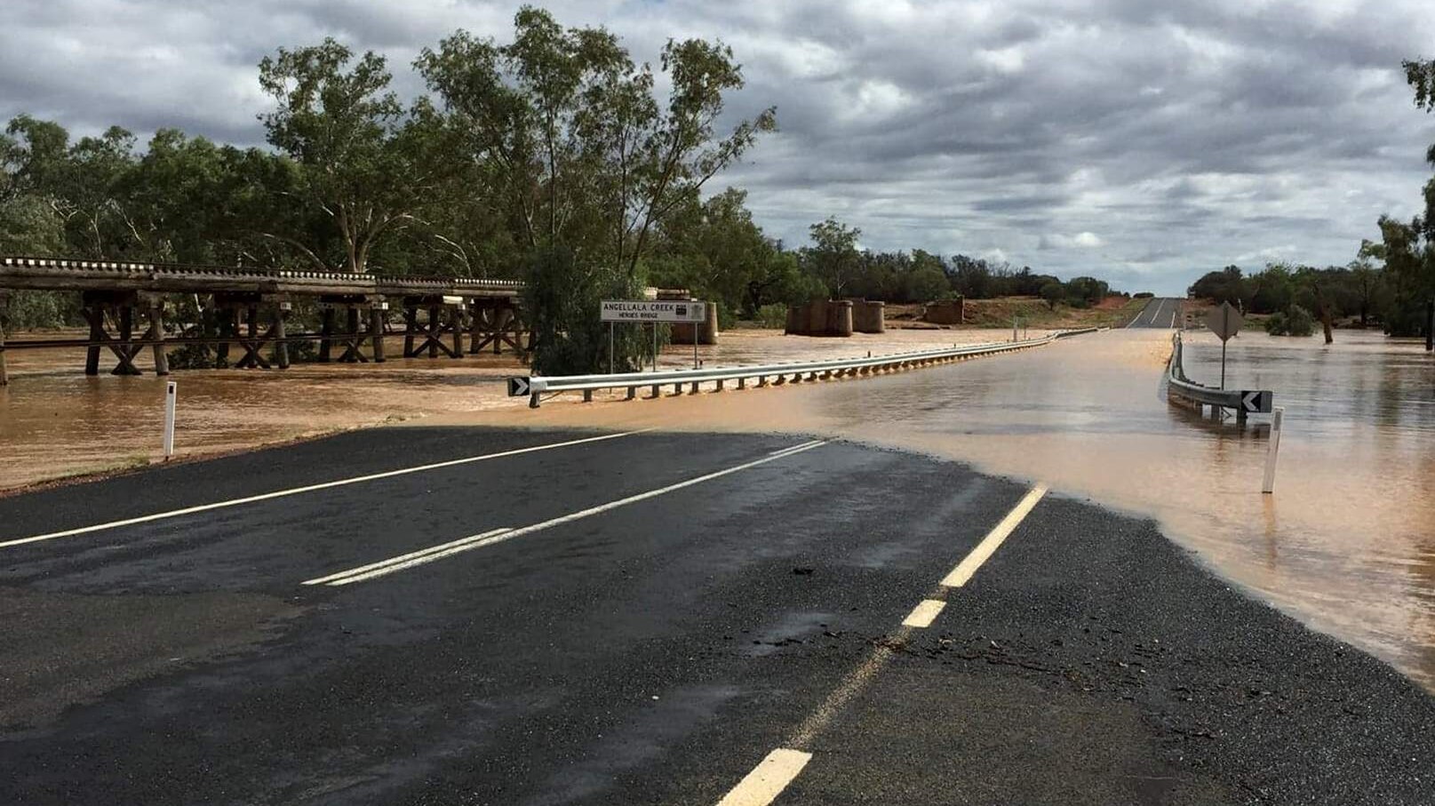
Outback Rivers Roar to Life
Central Australia has witnessed an extraordinary week of rain and storms. In certain pockets of the Northern Territory and South Australia, rainfall amounts reached up to 200 millimetres. For Kati Thanda-Lake Eyre, notoriously one of the driest regions in the country, this represents approximately a year’s worth of precipitation. This uncharacteristic desert deluge has transformed the landscape, causing normally dry creeks and rivers to swell dramatically, rising as much as five metres in mere hours.
In Alice Springs, the Todd River has been flowing continuously since Saturday, following upstream recordings of up to 191mm. The town’s airport alone received 125mm of rain within a week, a figure that triples the average rainfall for February. The exceptionally moist air mass responsible for these events is now contracting and moving towards tropical and eastern Australia. Weather modelling also suggests a possibility of further humid air from the north returning to central Australia towards the end of next week, indicating that heavy rainfall could persist in the region before the month concludes.
Queensland on High Alert for Rain and Storms
While the skies are beginning to clear over central Australia, the band of rain and storms has now shifted its focus to the eastern seaboard. The heaviest rainfall overnight impacted the far north coast of New South Wales, with Doon Doon, located just inland from Byron Bay, recording an impressive 241mm. The Gold Coast also experienced totals exceeding 100mm, marking the most substantial rainfall since Cyclone Alfred.
As of Friday afternoon, intense rainfall continued to batter the Gold Coast and adjacent inland areas, with rates of up to 30mm per hour being observed. The Bureau of Meteorology’s Severe Weather Warning indicated that this zone of heavy rain could migrate northwards, potentially affecting Brisbane and the Sunshine Coast throughout the day.
Flood Watch Issued for Key Regions
Looking ahead to Saturday, the most significant risk of flash flooding is anticipated across a broad expanse of inland Queensland, where thunderstorms are expected to remain a threat. However, heavy rainfall, not necessarily accompanied by lightning and thunder, could also impact south-east Queensland and northern New South Wales over the weekend. This scenario is particularly likely if a convergence zone of moist winds develops near the coastline.
Current weather modelling predicts that between now and Monday, a further 50 to 100mm of rain is likely to fall across a wide area stretching from inland tropical Queensland to the far north coast of New South Wales. This forecast has prompted a flood watch to be issued for more than 20 rivers, from the Central Highlands region down to the Northern Rivers. It’s important to note, as demonstrated by recent events, that isolated rainfall totals exceeding 100mm are entirely possible within this humid atmospheric environment, sometimes accumulating within just a few hours. Residents in these areas are urged to stay informed about weather updates and take necessary precautions.


