Roman Gold Mining Reshapes Spanish Pyrenees Landscape
For a considerable time, archaeologists have suspected that the distinctive terrain of a secluded valley in the Spanish Pyrenees bore the hallmarks of ancient Roman gold mining operations. Recent findings have now lent strong support to these long-held theories, primarily due to the discovery and precise dating of a submerged hydraulic reservoir.
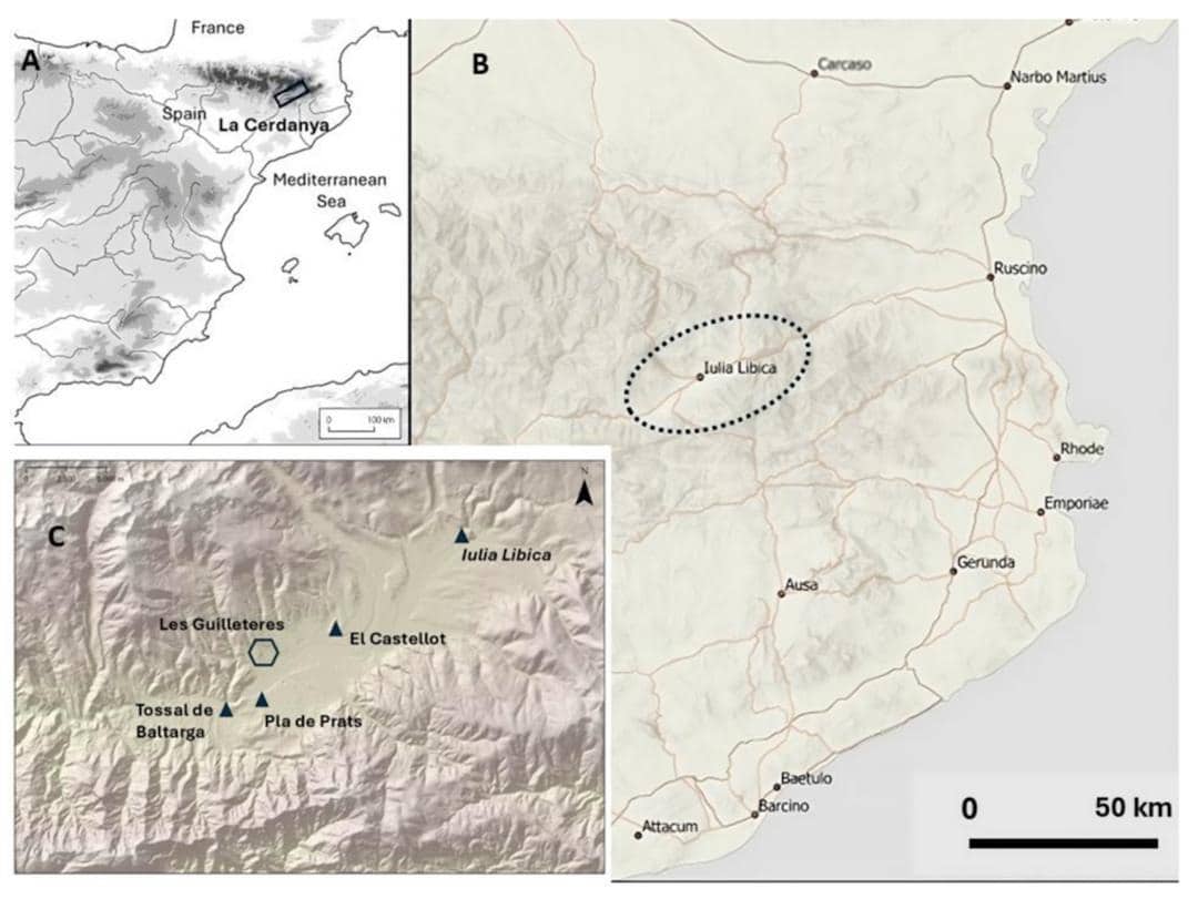
The site, identified as Guilleteres d’All, is situated within the Cerdanya Valley in the northeastern reaches of Spain. At first glance, it presents as a typical, rugged mountainous environment. However, a more detailed examination reveals a landscape sculpted by human intervention, featuring deep trenches, man-made ravines, and expansive excavation fronts that defy purely natural geological processes.
A significant study, spearheaded by researchers from the University of A Coruña and the University of Barcelona, has now presented the most compelling evidence to date that Roman engineers were actively extracting gold in this region approximately two millennia ago. Their methods involved the sophisticated application of water-management techniques.
A Mountainous Canvas Transformed by Roman Ingenuity
The tell-tale signs have been apparent for many years. Across the Guilleteres d’All site, archaeologists have identified a series of narrow trenches, steepened slopes, and even a colossal circular excavation measuring roughly 300 metres in diameter. In their findings, published in MDPI, the researchers characterise these features as the remnants of an elaborate hydraulic mining system. Rather than employing direct excavation, Roman miners ingeniously harnessed the power of water. They directed streams to dislodge and wash away ancient sediment deposits, which were known to contain minute gold particles.
This sophisticated technique necessitated the meticulous construction and regulation of an extensive network of channels and reservoirs. Water was channelled to saturate the mineral-rich deposits, effectively eroding and transporting the soil and gravel downstream, thereby facilitating the recovery of the gold suspended within.
While the scale of operations at Guilleteres d’All might not rival that of Spain’s most renowned Roman mining complex, Las Médulas, it was by no means insignificant. The research team estimates that an staggering 2 million cubic metres of earth were moved at Guilleteres d’All. This immense undertaking has undeniably left an indelible mark on the landscape, a testament to Roman engineering that remains visible today, nestled beneath peaks that soar to nearly 2,900 metres.
The Missing Piece: An Ancient Reservoir Unlocks Chronology
The primary enigma surrounding the Guilleteres d’All site was not the nature of its past activities, but rather the precise timing of those activities. For years, archaeologists held a strong conviction of a Roman origin for the altered landscape, yet they lacked definitive proof. This changed dramatically during extensive excavations conducted between 2010 and 2022, a period that yielded the remarkable discovery of an ancient reservoir, concealed beneath centuries of accumulated sediment.
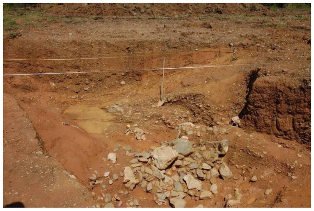
This carefully constructed reservoir was designed to store and control the flow of water essential for the mining operations. It measured approximately 4.5 metres in width and 1.5 metres in depth, reinforced by a retaining dam constructed from substantial stone blocks. Following the cessation of the mining system, fine sediment gradually settled at the bottom of the reservoir, forming distinct layers. These layers proved to be the crucial chronological key that researchers had been seeking.
To ascertain the age of these sedimentary deposits, the team employed optically stimulated luminescence (OSL) dating. This scientific method measures the last time buried quartz grains were exposed to sunlight. As detailed in the study, the analysis of two samples collected from the reservoir floor provided a critical chronological marker for the site.
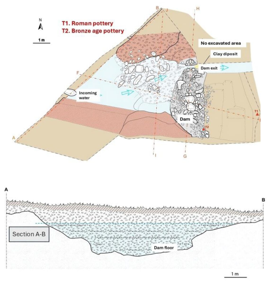
The OSL dating results unequivocally indicate that the hydraulic mining system was decommissioned between the late second century and the early third century CE. While this dating does not pinpoint the exact commencement of mining activities, it firmly establishes the site’s operational period within the Roman era.
Historical Texts Echo Pyrenean Gold Discoveries
This significant discovery also serves to connect a series of previously disparate pieces of archaeological and historical evidence from the surrounding region. The mines are strategically located in close proximity to Iulia Libica, which is known today as Llívia, and holds the distinction of being the sole confirmed Roman city within this particular segment of the Pyrenees. The study’s authors propose that this settlement likely played a pivotal role in the management of local resources and the broader economic activities of the era.
The researchers further highlighted that historical texts had already hinted at the presence of gold in the Pyrenean region. The renowned Roman encyclopaedist Pliny the Elder, in his writings, spoke of the gold-bearing wealth of the Pyrenees. Similarly, the poet Martial referenced gold originating from the vicinity of Iulia Libica, further corroborating the potential for significant gold extraction.
Archaeological finds unearthed in the area have progressively reinforced these long-standing suspicions. Notable among these discoveries are a metallurgical workshop found at El Castellot de Bolvir and a substantial 23-gram gold bracelet, recovered from a nearby Roman cemetery.
The new dating evidence provided by the Guilleteres d’All reservoir finally brings these disparate clues into a cohesive narrative. The study also points out that certain areas of Iulia Libica appear to have been abandoned around the same period that the mining infrastructure ceased operations, suggesting a shared timeline for both the settlement and the extensive gold extraction complex.